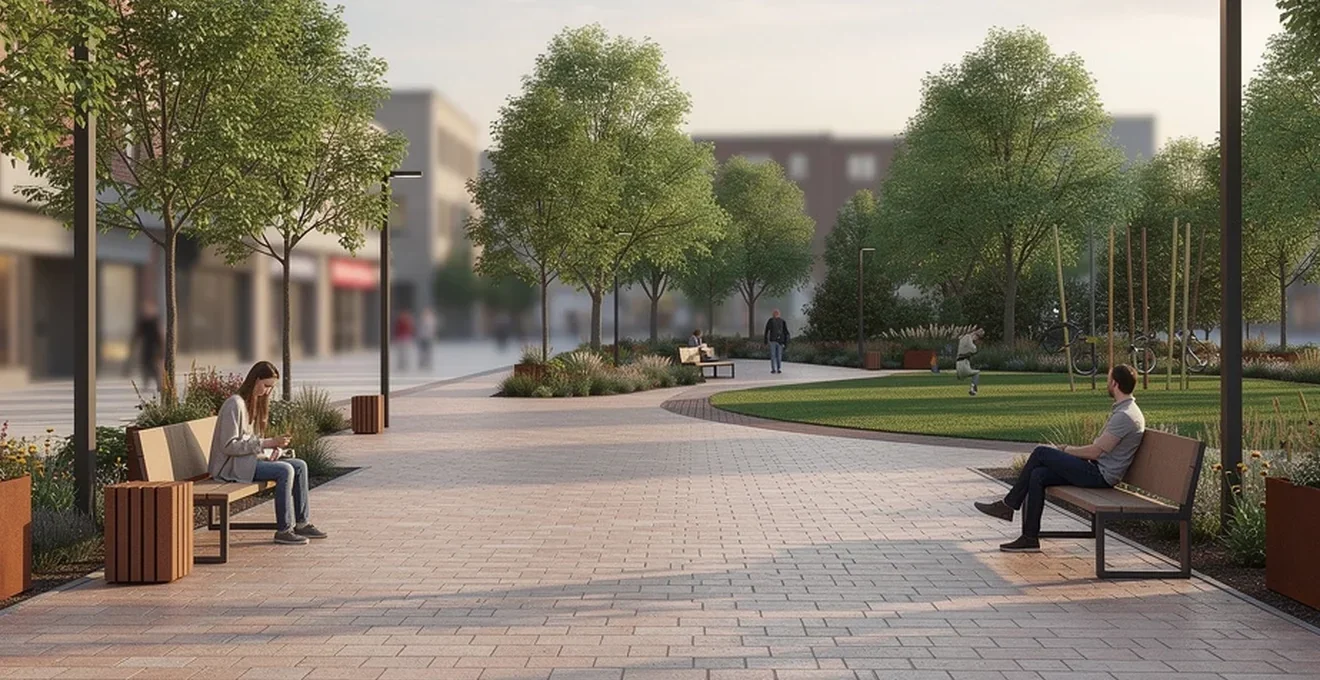
The best cities feel joined-up. A street flows naturally into a square, a square opens onto a park, and the transition barely registers because the materials, lighting, planting and signage share a common language. Achieving that consistency is not accidental. It relies on a set of urban design principles, material choices and community processes that work together across an entire public realm network rather than in isolated projects. This article sets out the core design theories, hardscape and green infrastructure strategies, wayfinding systems, lighting standards and engagement frameworks that help cities build streets and parks people actually want to use. Whether you are a planner, designer or local authority officer, understanding how these elements interact is the first step towards creating public spaces that feel coherent, safe and genuinely attractive.
Urban design principles for cohesive public realm development
Consistency across a public realm does not mean uniformity. It means applying a shared set of design principles flexibly enough to respond to local character while still giving people a coherent experience as they move from street to plaza to park. Two theoretical frameworks underpin most contemporary approaches to this challenge.
Kevin lynch’s image of the city and legibility theory
Kevin Lynch’s research into how people mentally map cities identified five elements that shape our understanding of urban space: paths, edges, districts, nodes and landmarks. A legible city is one where these elements are clear and memorable, allowing people to navigate intuitively without relying on signage alone. In practical terms, this means streets (paths) should have a recognisable identity, park boundaries (edges) should be well defined, neighbourhood centres (nodes) should feel distinct, and landmarks should punctuate the journey at meaningful intervals. When public realm schemes ignore legibility, the result is often a confusing patchwork where every street and space looks the same, or conversely, where nothing feels connected at all.
Jan gehl’s Human-Scale design methodology
Jan Gehl’s work shifted the focus of urban design from moving vehicles to observing how people actually behave in public space. His methodology emphasises designing at the pace and scale of a pedestrian: narrower sightlines, active ground-floor frontages, generous footways, and details that reward slow movement rather than speed. This human-scale approach aligns closely with the placemaking principle that if you design for cars, you get traffic, but if you design for people, you get vibrant public life. Applying Gehl’s methods consistently across a network of streets and parks means prioritising seating, shade, edges to lean against and spaces that invite lingering, not just passing through.
Streetscape continuity through material palette selection
A limited, well-considered material palette is one of the simplest ways to create a sense of continuity across a large area. Repeating the same paving units, kerb details, tree pit surrounds and street furniture finishes as a route moves from a busy high street into a quieter park approach helps people read the whole journey as a single, considered environment. This does not preclude variation — a heritage square might warrant a different surface treatment to a modern plaza — but the transitions should be deliberate rather than the result of piecemeal, uncoordinated interventions by different departments or contractors over time.
Sightlines and visual corridors in spatial planning
Clear sightlines help people orient themselves and feel safe. Planning visual corridors that connect a street to a park entrance, or frame a view towards a landmark building, reinforces legibility and encourages movement between spaces. This requires coordination between landscape architects, highway engineers and planners early in the design process, since decisions about tree planting, signage height, and building setbacks all affect what can be seen and from where.
Street furniture and hardscape material selection
The physical materials chosen for benches, bollards, paving and planters do much of the work in establishing whether a public realm feels considered or neglected. Material selection needs to balance durability, maintenance costs, sustainability and visual coherence.
Corten steel and weathering applications in bollards and planters
Corten steel, which develops a stable rust-like patina over time, has become a popular choice for bollards, planters and edging details because it requires minimal maintenance and ages in a way that many designers consider attractive rather than a sign of decay. Its warm, earthy tone also works well alongside natural stone and timber, making it a useful unifying material where a scheme spans several different types of space.
Permeable paving systems for sustainable drainage (SuDS)
Permeable paving allows rainwater to filter through the surface rather than running off into overloaded drainage systems, making it a core component of sustainable drainage systems (SuDS). Beyond its environmental function, permeable paving can be specified in finishes that match or complement surrounding hard landscaping, meaning drainage performance need not compromise visual consistency between a street and an adjoining park or square.
Granite setts versus concrete block paving in heritage zones
In heritage or historic town centres, the choice between traditional granite setts and modern concrete block paving is often contentious. Granite setts offer durability and a texture appropriate to older street patterns, but can be more expensive and less accessible for wheelchair users or those with mobility difficulties if laid without care. Concrete block paving is more cost-effective and can be manufactured to closely resemble natural stone, but may not weather in the same way over decades. The right choice depends on the character of the area, budget constraints and accessibility requirements, and should be considered as part of a wider streetscape strategy rather than in isolation.
Modular bench systems from manufacturers such as landscape forms
Modular street furniture systems allow the same family of benches, litter bins and cycle stands to be adapted to different site conditions while maintaining a consistent design language. Specifying furniture from a coordinated range, rather than sourcing pieces individually for each project, helps ensure that a bench outside a shop on the high street feels like part of the same family as seating in the nearby park.
Green infrastructure integration across streets and parks
Green infrastructure is what physically stitches streets and parks together, softening hard surfaces and delivering environmental benefits alongside visual continuity.
Urban tree canopy strategies and species selection for pollution tolerance
A well-planned urban tree canopy provides shade, improves air quality and softens the appearance of streets lined with buildings and hard surfaces. Species selection needs to account for pollution tolerance, root space constraints, and resilience to a changing climate, since street trees face harsher conditions than those in open parkland. Choosing a limited palette of robust, climate-resilient species across a city helps establish a recognisable green identity while reducing vulnerability to disease outbreaks that can devastate a single-species avenue.
Rain gardens and bioswales as linear park connectors
Rain gardens and bioswales — planted channels designed to slow, filter and absorb stormwater — can double as green connectors that visually and ecologically link streets to parks. Positioned along a route, they create a continuous ribbon of planting that guides pedestrians while managing water sustainably, reducing pressure on conventional drainage infrastructure.
Pocket parks as transitional green nodes within street networks
Small, well-designed pocket parks can act as stepping stones between larger green spaces, offering moments of respite within a dense street network. As demonstrated by projects that transform modest sites — vacant lots, underused plazas or even former shopfronts — into flexible community spaces, size is far less important than thoughtful design. A pocket park with clustered seating, shade and a clear sense of enclosure can generate the kind of everyday social interaction that larger, more distant parks cannot always provide.
Wayfinding systems and signage consistency
Consistent wayfinding reduces confusion and encourages people to explore further on foot, which in turn supports the wider goal of connecting streets and parks into a single, walkable network.
Legible london wayfinding model as a case study
The Legible London wayfinding system is widely referenced as a model for city-wide pedestrian signage. It uses a consistent family of monoliths and fingerposts featuring simplified, walker-focused maps that orient users in the direction they are facing, rather than a fixed north. This approach prioritises how people actually navigate on foot, and its consistent visual identity helps users trust the information regardless of which part of the city they are in.
Typography and pictogram standardisation across public assets
Standardising typefaces, colours and pictograms across all public realm signage — from park entrance boards to street name plates and transport information — reinforces a sense of coherence and makes information easier to process quickly. Inconsistent signage, by contrast, can make even a well-designed space feel disjointed and undermine confidence in wayfinding.
Digital kiosk integration with physical signage networks
Digital kiosks offering real-time information, transport updates or interactive maps are increasingly integrated alongside traditional physical signage. For this integration to succeed, digital elements need to follow the same visual language and hierarchy as the physical wayfinding network, so that they feel like an extension of the system rather than a separate, competing layer.
Lighting design for safety and ambience continuity
Lighting shapes how safe and welcoming a public space feels after dark, and inconsistent lighting standards between streets and parks can create abrupt, unsettling transitions.
LED colour temperature standards across streets and parks
Standardising LED colour temperature across a public realm scheme helps avoid the jarring shift from warm-toned street lighting to a starkly different tone in an adjoining park. A consistent, carefully chosen colour temperature supports both a pleasant ambience and safe visibility, and is generally easier and cheaper to maintain than a mix of differing lighting technologies inherited from separate projects.
CPTED principles in nighttime public space illumination
Crime Prevention Through Environmental Design (CPTED) principles emphasise natural surveillance, clear sightlines and well-lit routes as ways of discouraging antisocial behaviour without resorting to heavy-handed security measures. Poorly lit or poorly maintained parks and underpasses can become associated with fear and crime, repelling the very people and investment that public space improvements are meant to attract. Applying CPTED thinking consistently across streets and parks — ensuring no unlit “dead zones” exist at the boundary between the two — is essential to maintaining a sense of safety throughout a journey.
Smart lighting networks and adaptive dimming technologies
Smart lighting networks that adjust brightness according to pedestrian activity, time of day or weather conditions offer both energy savings and improved responsiveness to how a space is actually used. Adaptive dimming can maintain a baseline of safety while reducing light pollution during quieter hours, and centrally managed systems make it easier to keep lighting levels consistent across a wide network of streets and parks.
Community engagement and placemaking frameworks
Physical design decisions are only part of the picture. The most successful and enduring public spaces are shaped by the people who use them, through structured engagement processes that build ownership and long-term stewardship.
Project for public spaces (PPS) placemaking methodology
The Project for Public Spaces defines placemaking as a method that invites people to collectively reimagine and reinvent public spaces as the heart of their community, considering the physical, cultural and social identity of a place alongside the needs of different users. This philosophy has informed projects around the world, from the aerial Metrocable system in Medellín — which connected marginalised hillside neighbourhoods to the city’s transport network and dramatically reduced crime — to the revitalisation of Bogotá’s public realm under former mayor Enrique Peñalosa, which combined the TransMilenio bus rapid transit system with car-free Ciclovía events to reclaim streets for pedestrians and cyclists.
What defines the character of a city is its public space, not its private space.
That principle, attributed to Dr Joan Clos, former Executive Director of UN-Habitat, underpins the PPS approach: the goal is not simply to install attractive features, but to build the social fabric of a community through the spaces it shares.
Participatory design workshops for local stakeholder input
Participatory workshops give residents, traders and local organisations a direct role in shaping design outcomes. In Gyumri, Armenia, a single day-long Placemaking workshop attended by more than seventy local people sparked an unprecedented cross-sector collaboration that culminated in a festival drawing an estimated 35,000 people to a square that had lain dormant since a devastating 1988 earthquake. Similarly, the Kounkuey Design Initiative’s work in the Kibera settlement in Nairobi relied on numerous community workshops to prioritise needs and co-design solutions, resulting in a project combining a poultry farm, drainage improvements, a community centre and a playground built from locally sourced materials. These examples demonstrate that the most meaningful design decisions often emerge from listening to residents first, then applying technical expertise to enhance their ideas.
Tactical urbanism pilots as precursors to permanent redesign
Public spaces are complex and rarely get everything right on the first attempt. Tactical urbanism — testing “lighter, quicker, cheaper” interventions such as temporary seating, painted crosswalks, pop-up cafés or community events — allows designers to trial ideas, gather feedback and refine them before committing to permanent, costly infrastructure. This approach was central to the transformation of Summit Lake in Akron, Ohio, where a temporary “beachhead” using step-stone rocks to define the shoreline, along with picnic tables and porch swings, tested community response before evolving into a permanent park with canoeing, community gardens and a farmers’ market. The lesson is consistent across many successful projects: if one intervention does not work, try another; if something succeeds, build on it. This iterative, low-risk approach is often the most reliable route to a permanent public realm that genuinely reflects what a community needs.